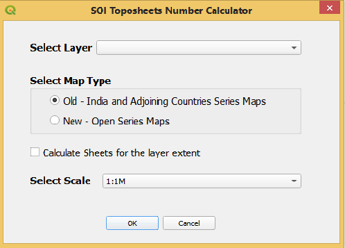
TopoSheet Number Calculator Version 2 for QGIS3
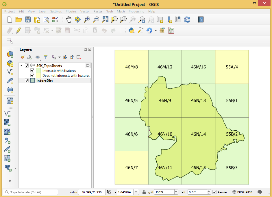
This QGIS Python Plugin calculates the map sheet numbers for the Survey of India Topographical maps from the features of the selected layer. It computes the boundaries of all the sheets for the layer extent and adds a polygon layer representing the sheet boundaries. The polygons representing sheets are labeled with sheet numbers. The sheet polygons which intersects with the input/selected layer feature are filled with light green color and those not intersecting are filled by yellow color.
The plugin provides option for the calculation of old series maps (India and adjoining countries Series Maps) as well as new Open Series Maps (OSMs) on Universal Transverse Mercator (UTM) projection System with World Geodetic datum introduces in the year 2005.
The map sheet numbers for all available scales for both types of maps can be calculated.
By default the map sheet numbers for the sheets intersecting with the features are calculated, but the sheets for the entire extent of the layer can also be calculated.
The input layer features may be point/line or polygon. The CRS (Coordinate reference System) of the layer should be EPSG:4326, WGS 84. The layers with projected coordinates like UTM are not accepted /selected by the plugin. Further the values of Geographic coordinate (latitudes and longitudes) should not be out side the Indian region.
The user interface of the plugin is shown below:
The sample output showing the sheet boundaries is shown below: